

Dredging Statistics for 2005
The Crown Estate reports on their website that the British Marine Aggregate Producers Association (BMAPA) have since March 1999 been slowly surrendering dredging areas where sand and gravel deposits are exhausted, whilst seeking licences in virgin areas where aggregate stocks have been located from the Department for Communities and Local Government (DCLG), (formerly the ODPM, the Office of the Deputy Prime Minister).
The licensed, dredged and surrendered during 2005 are based on data from The Crown Estate Offshore Marine GIS and from analysis of dredger Electronic Monitoring System records, updated from 2005, show the extent and intensity of dredging operations and the figures for the active dredge area, that area in square kilometres actually available to be dredged at any one time.
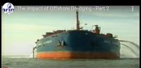
The report points out that dredging offshore for aggregates began in the early Twentieth Century, but it did not reach a significant scale until the 1970s, as markets for marine aggregates expanded and dredging technology improved. Almost all marine aggregate extraction takes place from licences on seabed owned by The Crown Estate which owns 55% of the foreshore and all of the seabed out to the 12 mile territorial limit. Its origins date back to the reign of King Edward the Confessor.
The Crown Estate is part of the hereditary possessions of the Sovereign ‘in right of the Crown’ managed under the provisions of The Crown Estate Act 1961 by The Crown Estate Commissioners who have a duty to maintain and enhance the value of the Estate and the income derived from it. The net revenue surplus is paid to the exchequer.
The British Marine Aggregate Producers Association (BMAPA) was formed in 1992 and comprises members of the Quarry Products Association with a marine interest. Marine sand and gravel is supplied to home markets and as exports to Continental Europe. In addition, marine aggregates are employed in supporting beach replenishment schemes.
The marine aggregates industry operates over 25 vessels on 71 production licences around the UK. The BMAPA membership is comprised of:
- Britannia Aggregates Ltd
- CEMEX UK Marine Ltd
- DEME Building Materials Ltd
- Hanson Aggregates Marine Ltd
- Kendall Bros. (Portsmouth) Ltd
- Lafarge Aggregates Ltd, Northwood (Fareham) Ltd
- Norwest Sand and Ballast Company
- United Marine Dredging Ltd
- Volker Dredging Ltd.
The report shows a slight drop in that a total of 21.09 million tonnes of sand and gravel were dredged from Crown Estate licences in England and Wales during 2005, compared to 21.45 million tonnes in 2004. The total area of seabed licensed in 2005 decreased slightly to 1179 km² in 2005, compared to 1257 km² in 2004. Dredging took place within 137.6 km², 11.7% of the licensed area, a slight increase compared to 134.5 km² (10.7%) in 2004.
Here follow the dredging regional statistics for 2005. Note that by far ther greatest area is that off Eastern England, with that off East Anglia the greatest of all.
| Region | Total Area Licensed in 2005 (Sq Km) | Total Active Dredge Area for 2005 (Sq.Km) | Total area dredged during 2005 (Sq.Km) |
| Humber | 483.68 | 146.70 | 31.17 |
| E.Coast | 268.00 | 182.96 | 52.48 |
| Thames | 102.87 | 93.36 | 12.30 |
| S.Coast | 215.45 | 100.37 | 29.35 |
| S.West | 54.41 | 49.55 | 10.24 |
| N.West | 54.95 | 19.96 | 2.01 |
| Total (km²) | 1179.36 | 595.90 | 137.55 |