Why Canute Failed
History
Many thousands of years ago there was no North Sea. East Anglia was joined by dense oak forests to the European mainland .The only reminders of this remaining today are the semi-petrified tree stumps appearing at Norfolk’s rapidly eroding Holme beach and the roots of the ancient oaks that are washed up along the Norfolk coastline following dredging and severe south-westerly gales. Then came the ‘English River’, which slowly enlarged to become the North Sea.
For many centuries now the East Anglian coastline has been slowly eroding for natural reasons. Apart from the effects of the onslaughts of major storms and surges, this has been a steady but nevertheless relentless regression. Beaches normally show sand loss over the winter months because the strong onshore northerly winds create an undertow taking the mobile sand and shingle out to sea. Where once it was brought back to the shore by the opposite south to south-west summer winds, this previous balance now is mainly lost. Since the onset of Offshore Aggregate Dredging the traffic seems to be one-way only.
The Eurasian tectonic base plate collision with the North American plate is causing Scotland to slowly rise from the sea, coupled by the elevation that followed the melting of the icecap, with the resulting tip effect causing south-east England to sink. Further, the melting of the weighty glaciers of the ice age have permitted Scotland to rise. Although the East Anglian sink rate was as much as 3 millimetres per year in the past, it is now judged to be in the region of 1.5mm per annum and still reducing. Kent, Essex, Suffolk and Norfolk plus part of Lincolnshire are very slowly sinking. Man does not have the technological ability to tackle this natural threat.
Since the industrial revolution of the nineteenth century earth warming has played its rôle in bringing about the encroachment of the sea. Increasing carbon dioxide emissions from power stations, industry, aircraft and traffic have resulted in ever rising sea levels. Polar ice cap and glacial melting is now adding two millimetres per year and the melt rate is increasing, whilst thermal expansion of the sea induces even more sea expansion giving a total rise of up to seven millimetres per annum. This factor is also increasing. The increase of severity and duration of northerly winter gales producing surges and bigger waves plus the increasing and deepening barometric lows that accompany Global Warming serve further to escalate erosion and the rise and inland progression of the North Sea, so the threat of flooding.
Yet, the rapid increase of erosion of England’s eastern seaboard evidenced over the past twenty years is far greater than can be ascribed to the above factors in isolation. There is now strong supportive correlated evidence that offshore aggregate dredging is playing the major rôle in the loss of our coastal fringe. This has led to questioning the viability of our sea defences, which, in some form or other have been placed since before the time of the Romans. But the imposition of sea defences themselves, whilst protecting that section of the coastline intended, can aggravate erosion along sections of the shoreline not so protected by their attenuation of the littoral sediment driftlittoral sediment flow This is the flow or movement of sediment (sand, shingle or pebbles) along a beach or coastline. The flow or direction of movement is usually determined by the tidal and wave regime dominant in the area., hence causing sand and gravel starvation to create hotspots of erosion. Piecemeal protection due to decisions to underfund allows this. Only by total defence, as practised in The Netherlands, can this be avoided.
The natural mechanism of sand balance is now rapidly being lost, because the causes are no longer natural, but man made on a massive scale.
To quote Professor Keith Clayton, emeritus professor of the School of Environmental Sciences at the University of East Anglia: –
“The best beach is a natural beach, where the sand is free to come and go. It will disappear in some places, and appear in others, free to come and go with the wind and the tides.”
Whilst his considerations are obviously true and eminently sensible, we do not have natural beaches today. Dubious forms of defence have had their impact all along our coastline, many at the expense of adjacent areas. The sand and gravel movement has been impeded, and now the sand goes and does not return due to seizure by offshore dredging, and that’s decidedly not ‘natural’.
Natural Beaches
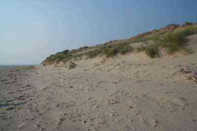
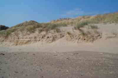
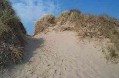
A natural beach at Aberdovey, Wales, where there are no licensed dredging sites within 100 miles. The dune system thus adequately protects the shoreline and maintains the sand balance.
Although few people other than small fishing communities lived close to the sea in early days, those that did maintained their coastline by natural means. First they would plug in lines of brushwood along and above the tide line to capture the wind blown sand and tide provided debris to form a ridge, then plant marram, a saline tolerant grass, which would form marram hills to grow to stabilize the structure. (see ‘DIY Dune System’ under Marine Aggregate Dredging on this website)
If a storm and very high tide came about, any marram undercut and freed would automatically drift with the tide to wash up on down tide beaches to form additional dune systems, all leading to an elongated well protected and aesthetically delightful shoreline vista.
But such natural dune systems are not without their limitations. Where popular holiday beaches bring many people, damage to the dunes can result. If one walks upon marram only three or four times damage will result to the roots. The flattened fronds will no longer capture the seaside run-down of evening dew moisture and the plants will dehydrate, to be blown out by the wind, this allowing the sand itself to blow out. An ever enlarging hole results, through which the sea can eventually enter to destroy the inland area.
(1) Hard Defended Beaches
As technology increased, more intrusive but nevertheless highly effective shoreline defences were created by the use of groynes. These were formed by driving a line of stout piles into the beach at right angles to the sea, and bolting thick hardwood planks between them. Both the wind blown and littoral sand drift was thus captured, so building and maintaining an adequate beach.
With low cost and a reasonable working lifetime, they did the job for many years. But drawbacks exist. One is that they tend to ‘trap’ the sand denying downflow of the sediments to non-protected beaches. The other is that they can alter the nearshore currents to bring about pockets of sand starvation.
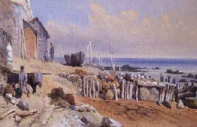
This 1863 oil painting of the beach at Bonchurch on the Isle of Wight by Victorian artist Thomas Lesson Rowbotham, showing how large boulders were used encased by wooden groynes even in those times.
Battered by storms over many years, these groynes have a finite lifetime. Despite warnings on their decay by those that knew and understood the necessity, the vitally required maintenance and refurbishment of these decreased with the passage of time, due to lack of funding. The result was the great Norfolk flood of 1938, when many hundreds of acres of farmland were flooded and houses were lost when the sea broke through at Horsey. Again in 1953 the sea broke through, for exactly the same reasons. This time the damage and cost was enormous with almost 300 lives lost.
For the past thirty years the groynes, now including many made of hardier metal, have again been allowed to decay, at the same time that offshore dredging is denying the essential sand supply. The massive erosion now seen at Happisburgh and many other parts of the shoreline would not have come about had the sea defences been maintained.
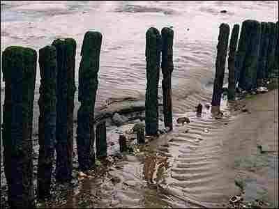
Many places still show what remains of these neglected groyne defences.
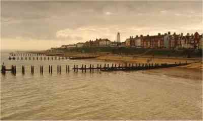
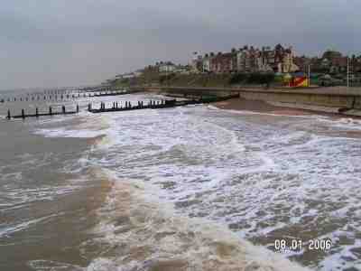
Two photographs of wooden groynes at Southwold, Suffolk, showing how lack of needed maintenance has allowed the loss of many of the hardwood planks that previously existed between the upright posts. Serious erosion has recently resulted here due to beach draw-downdraw down The process by which tides and wave motion remove (draw down) material from a beach and pull it out to sea. A sandy beach experiencing draw down is thus denuded of its sand. The process can be natural (i.e. winter storms) or can be artificially caused (e.g. aggregate dredging, whereby the dredging of sand and gravel offshore causes sand to be drawn down from the beach in order to replace the material which has been dredged). and consequent wave action steepening and seizing the beach.
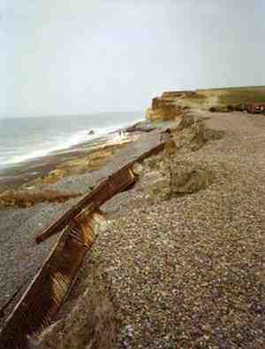
The remains of the once powerful steel sea defence system provided at Weybourne, North Norfolk, undermined by beach draw downdraw down The process by which tides and wave motion remove (draw down) material from a beach and pull it out to sea. A sandy beach experiencing draw down is thus denuded of its sand. The process can be natural (i.e. winter storms) or can be artificially caused (e.g. aggregate dredging, whereby the dredging of sand and gravel offshore causes sand to be drawn down from the beach in order to replace the material which has been dredged). following dredging and storms.
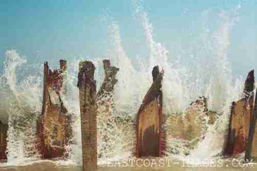
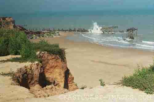
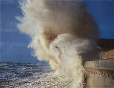
The above two photographs of sea buffeting the decayed groynes at Happisburgh have been kindly provided by Jenny Thompson of East Coast Images. Her website www.eastcoast-images.com depicts many images showing erosion along the East Anglian coastline.
Where serious erosion has come about, in some areas, the ailing groynes have been reinforced with hard Norwegian rock. A graphic example of the level of their effectiveness exists at Walton-on-the Naze in Essex, where the far groyne depicted has been maintained and in itself has been protected by rock piling, so sheltering the soft sand cliff at that point.
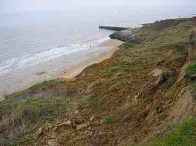
Walton on the Naze, showing the attenuation of erosion at the upper right of the picture by the combination of a stable well maintained groyne, itself protected by rock. But nearer to the north severe erosion is evidenced, undermining the sand cliffs so allowing them to collapse.
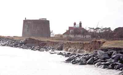
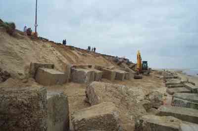
In November 2007 Peter Waller took the following photograph of the rocks placed against the soft sand cliff face to defend the Martello Tower in his area. It shows how the central section has sunk, exposing the cliff face to greater wave attack.
Other rock-aid is shown below, provided to halt the erosion brought about by the offshore reef sand denial at Sea Palling, Norfolk. This further example also serves as an excellent windbreak. It may not be the most aesthetically pleasing methodology, but in the absence of a sufficiency of funding, serves the purpose of assisting the stability of the beach, hence the dunes.
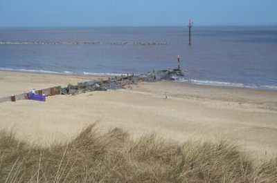
Rock reinforced original wooden groynes near Sea Palling, Norfolk at the termination point of the offshore rock reef, seen out to sea.
Even when placed on a fabric base these heavy rocks sink in the sand with time, but still offer some degree of protection from scouring of the beach, dunes and sand cliffs. Below are shown where the first set of rocks were placed at Caister-on-Sea. Whilst the rocks have almost disappeared, marram has re-established to help stabilize and protect the vulnerable inland area.
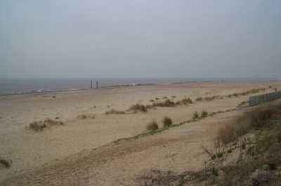
The (sand covered) promenade at Caister on Sea, showing the lines of marram with only a few of the original unsunk rocks still visible.
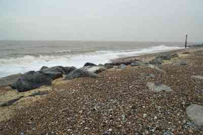
The sinking Rocks at the Caister shoreline showing how gravel has still built up behind the rock bunds placed along the shoreline.
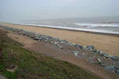
A more recent rock protection provided at California, Norfolk, showing minimum sinkage so far. Note again the build up of gravel behind them.
Replacing many of the old wooden groynes, later came the day of mightier engineering in the form of concrete walls. The first were made from large rectangular flat faced blocks of concrete, however, these were found to be vulnerable. The impact of powerful waves on a high tide caused the waves to be deflected not only over and above the wall but to the base also. This resulted in toe erosion of the structure, so eventually leading to the loss the wall. These walls can also bring about the demise of adjacent unprotected beaches due to redirection of the wave energy.
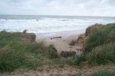
The original flat faced concrete sea wall breached at vulnerable Caister on Sea, Norfolk, following a heavy storm over Christmas, 2003.
Following the discovery of the limitation of the earlier flat faced concrete, sea walls were later made with a concave frontage that acted to deflect waves back to the next incoming wave. But the disadvantage is that such hard defences cost over £9,000 per metre, and still allowed the sea to come right up to the wall on high tides when sediment stripping had caused beach draw down. With the sand lost and not replaced by the littoral sediment flowlittoral sediment flow This is the flow or movement of sediment (sand, shingle or pebbles) along a beach or coastline. The flow or direction of movement is usually determined by the tidal and wave regime dominant in the area., sooner or later the toe of the sea wall becomes exposed so threatening collapse. Furthermore, unprotected adjacent beaches can be damaged in the same way as by their flat faced forerunners.
At Sea Palling in north Norfolk, seven people including three children were drowned and many houses lost when the sea broke through a 100 metre wide gap in the dune defences in 1953. Behind Sea Palling are many villages and hundreds of acres of land at or even below sea level, including the Norfolk Broads. The initial response of the authorities was to rebuild the dune defence system by first filling the gap with sandbags. Much later a substantial sea wall was built from north Winterton almost to Happisburgh that served its purpose for many years until beach draw down began to cause the sea to encroach to its base.
But as the groynes decayed and as offshore dredging escalated, coupled with the rising sea levels and worsening climatic conditions brought about by global warming, the beach shortened and steepened, eventually to permit storm waves to undermine the sea wall base. To protect the toe of the sea wall, hard Norwegian rocks were placed along the base. But the danger now was that these, being far harder than the concrete, allowed the surging sea to cause the rocks to topple and smash into the much softer concrete sea wall.
Thus it was then decided to pump back a huge quantity of sand back onto the denuded beach to protect the wall from underminement. But because this sand was taken from offshore, the beach further steepened and the offshore water depth increased, giving even greater wave heights, so washing the deposited sand off the beach again to return to those deepened holes from whence it came. After several repeated attempts, it was eventually realised that further measures were essential to maintain protection.
A controversial and completely novel project was dreamed up, involving not the replacement of the functional wooden or rock groynes at 90 degrees to the shoreline, but to strip out the old groynes and provide a substantial reef of hard rock bunding parallel to the shoreline. Such an experimental reef was positioned well offshore to the beach. But now a further danger arose, in that a tidal race could result between the rock bunds and the wall that could further strip out the sand between them.
It did just this on the following (minor) surge, so even more sand was piped onto the shore, raising the beach level but further increasing the offshore sea depth, so taking the sand back to the deepened area and further allowing even bigger waves to strip the beach.
Eventually, by spacing the reefs and by fish-tailing the ends of the bunds, Sea Palling was allowed to maintain a sufficiency of sand to stabilize the situation and so secure the inland areas. The sand built up well immediately behind the lines of rock, but was still lost to the littoral flowlittoral sediment flow This is the flow or movement of sediment (sand, shingle or pebbles) along a beach or coastline. The flow or direction of movement is usually determined by the tidal and wave regime dominant in the area. in the gaps between them.
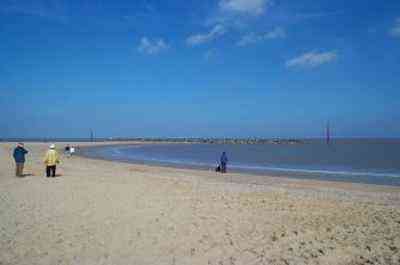
Beach view of Sea Palling showing how the sand is maintained behind the rock bunds, but not in the gaps between them in the foreground.
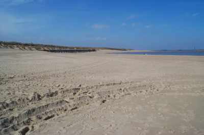
Another beach view of Sea Palling showing how the beach suffers draw down behind the gaps between the bunds, leaving the toe of the sea wall exposed and vulnerable.
With this a further problem arose, in that the captured sand denied deposition on the downtide coast to the south-east. With nearby Waxham stripped of its sand replacement, it rapidly lost the entire beach to become a soft clay marlMaerl Maerl is a collective term for several species of red seaweed, with hard, chalky skeletons. It is rock hard and, unlike other seaweeds, it grows as unattached rounded nodules or short, branched shapes on the seabed. Like all seaweeds, maerl needs sunlight to grow, and it only occurs to a depth of about 20m. morass which was lowering at a fast rate, so endangering the sea wall there.
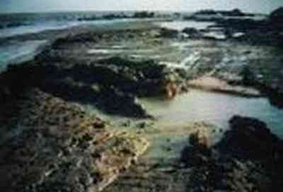
Waxham ‘Beach’, once an extensive 100 metre sandy beach, was sand stripped down to the soft marl following the Sea Palling defence experiment. Since ninety degree to the shoreline hard rock groynes have been placed to attenuate the beach loss, it has since gained much coverage, but Waxham still remains highly vulnerable.
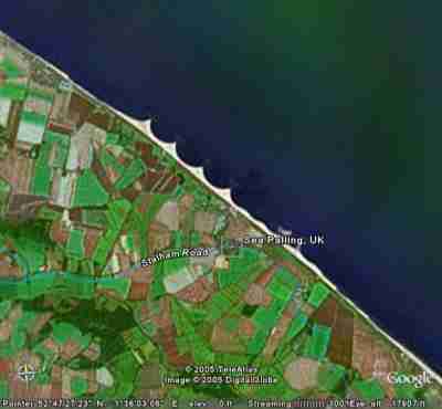
Satellite image, courtesy DigitalGlobe, shows the effect of the spaced parallel to the shoreline rock reefs presently protecting Sea Palling and the low inland Brograve levels. Note the loss of beach build between the reefs and the depleted shoreline both to the north west and to the south east at Waxham, where sand denial is evidenced. Note too that the elevation as shown at the base of the map is 0 feet a.s.l., well below the normal high tide level for this area and some 3 metres below a surge tide.
But the sand at Sea Palling continues to be lost despite continuous high cost beach nourishment by replacement of sand dredged from the seabed. In line with their ‘managed retreat’ policy, in September 2005 the government announced that no further funding would be made available for this project. Thus, sooner or later, the sea wall will be breached, and a huge tract of inland area flooded. The sea will flood numerous low lying villages and enter the Broadland system to salinate and destroy the entire Broads natural wetland environment which has been highly valued up to now.
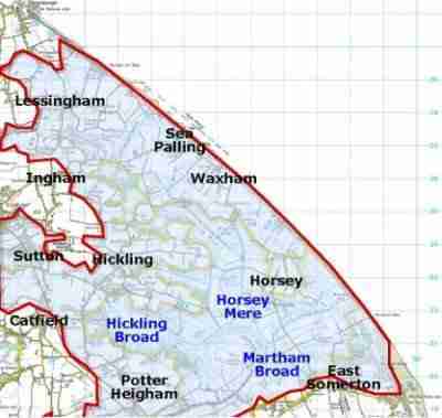
Map of north-east Norfolk showing (in blue) a small part of the extensive low lying inland area to be lost to the sea should the defences be allowed to fail.
Further to the south-east, Winterton-on-Sea’s beach and dunes were mainly accreting until a few years after offshore aggregate dredging reversed the situation. Only the marram dunes protected this frontage, but as the beach draw down progressed, these have been progressively undermined and lost. The following time lapse photographs taken from the same point depict this loss over the years.
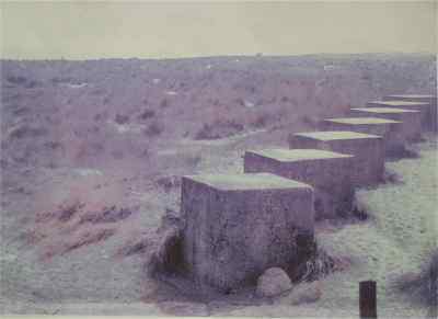
Winterton Dunes, which were still mainly accreting until nearly twenty years ago. This picture was taken in 1953 beside the lines of concrete tank-traps that were placed over 100 metres back from the sea in 1939 to deter invasion. It shows the original buildings close to the distant dune edge and an extensive dune system. The scene changed little from this until ca 1997, when the first signs of serious beach and dune loss came about.
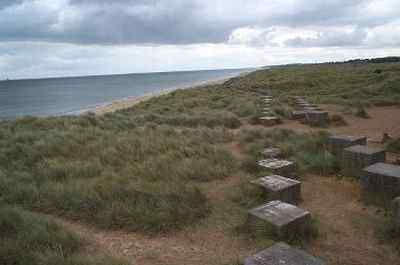
Seen in July 2002, the beach sand depth loss and consequent sea advancement is evidenced. Dune undermining had brought the sand dune cliff front to within some seven metres of the concrete blocks.
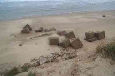
This photograph was taken in September 2002, just two months later. Even during the summer, when beaches would normally accrete, over ten metres of dune disappeared, allowing the blocks to be displaced to tumble down the steep dune front precipice onto the beach.
North Norfolk Council came to the rescue in an attempt to slow the rapid rate of erosion, because with the Coastguard Lookout gone and the valuable Beach Café, the public toilets and car park now threatened, urgent action was called for. As an ideal example of recycling, the heavy tank trap blocks scattered along the beach were moved by bulldozer to the new dune base. This has served its purpose, inasmuch as the rate of dune loss has been cut by some 70%. But sadly the blocks will slowly sink and the dunes behind them will be cut out as the beach denudes and when high tides and angry waves attack the coastline.
Of course, many of the man-made ‘hard’ structures employed to defend our coastline may be considered to be aesthetically displeasing, especially when employed in areas of high landscape quality, as they can fundamentally alter the character of the very coastline they are designed to protect. The Welsh Assembly show concern for the visual aspects of the many beautiful coastline areas of Wales, which cover three quarters of their coastline, so they have pioneered a superb paper with this in mind, entitled ‘New Guidance for Coastal Defence in relation to their Landscapes and Visual Impacts’.
It shows numerous examples as to how concrete, bleak boulders and other defences can blight the view for visitors and residents. The paper covers current policy and guidance, landscape and visual impact assessment, designs to complement the coastal setting and alternative types of coastal defence structures. It even provides a case study. However, it gives little input or guidance on the effectiveness of the various forms of defence described in protecting the coastline.
(2) Less Hard Defences
Geotubes
Geotubes are high strength woven geotextile containers used in the beach stabilising techniques. They are easy to install beneath the water surface, offer minimal impact on the environment and are a cost effective alternative when compared to traditional marine construction materials and methods.
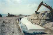
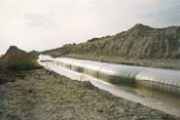
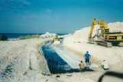 Geotubes were tried by Halcrow at Sea Palling in Norfolk, but were discovered not to stand up to the really violent wave conditions found there. They are currently being trialled in Suffolk.
The ‘Claw’
MARINET member Jim Robinson came up with a seabed placement idea that he would like to see propagated, and explains the novelty, explaining: –
“The shape is taken from a horse shoe crab but here the similarity ends. It is about the size of a wheel barrow and up to the size of a small car. To give one an idea what is does, if one places ones hand in a current of water with the fingers slightly extended one can feel the force of the water between the fingers. Matter held in suspension by the water will fall out and accumulate under the hand as the current slows. Around the hand where the current is slowed matter is deposited according to size. This forms the basis of the idea where a series of ‘KTs’ (as I have called them) will trap matter to form a barrier, so protecting the coastline and building up sand. Waves break over this structure and water flows inside and out again, but matter is deposited inside thus forming a barrier, all done by the force of the elements.”
For shore use he adds “In an example where damage is done by foot traffic on sand dunes, a series of these structures will allow regeneration of plant growth and divert foot traffic, also give a habitat to wildlife, with new growth protected from grazing animals.” As far as is known, this concept remains theoretical and has yet to be tried in practice.
A new form of ‘Groin’ – Undercurrent Stabilizers
David L. Schultz, a civil engineer in the USA, email address email hidden; JavaScript is required provides a short discussion on an Innovative Shore Protection Measure, writing in to us to say: –
“An alternative solution to the armour/retreat dilemma faced on our shores has been developed and perfected over the past twenty years. Undercurrent stabilizers (aka seabed groins, submerged groins and underwater groins) have consistently shown themselves to be effective at protecting bluffs and beaches without causing the erosion experienced with traditional shore protection structures. I have studied three installations of this system in depth, have reviewed other professional reports regarding three other installations, and I regularly inspect many more on a regular basis. The short story is that undercurrent stabilizers work.
“Recently, universities in Europe have studied this concept in depth. Full-scale models have been installed on the Mediterranean coast, with changes field-measured and correlated with advanced numerical computer models. Their conclusions have been as unequivocal as Dick Holmberg, the inventor of undercurrent stabilizers. Professor C. L. Goudas, of the University of Patras, Greece stated: ‘The seventeen in situ experiments showed that coastal erosion is terminated by CPNS (seabed groins) without exception.’
This statement coincides with that of Dr. David Barnes of Western Michigan University who in 1995 stated in part ‘Consistent profile volume gain (relative to a regional trend of profile volume loss) and significant foreshore/backshore accretion with no apparent negative impact down drift must be viewed as success in almost any context.
“Undercurrent stabilizers are concrete-filled geotextile tubes laid out perpendicular to the shore. They look the same as traditional groins only when viewed from above. Stabilizer cross-section geometries are diametrically different, and are a primary reason for their successful functioning. Traditional groins follow the water surface; hence they are larger and more impacting the deeper they go into the water. Undercurrent stabilizers are most massive at their landward anchor points and follow the bottom, becoming smaller as they go into the water. The tapering profile creates a condition where the structure is very permeable to littoral driftlittoral sediment flow This is the flow or movement of sediment (sand, shingle or pebbles) along a beach or coastline. The flow or direction of movement is usually determined by the tidal and wave regime dominant in the area. sediment, negating the downdrift sediment starvation experienced with traditional groins. Additionally, the rounded, low-profile presence of stabilizers generates much less wave reflection and turbulence than a high-profile, vertical structure. By reducing wave energy and facilitating littoral sedimentlittoral sediment flow This is the flow or movement of sediment (sand, shingle or pebbles) along a beach or coastline. The flow or direction of movement is usually determined by the tidal and wave regime dominant in the area. transport, negative impacts to adjacent properties are greatly reduced, and in some cases reversed. In my studies, I have witnessed downdrift beaches benefiting more than at the installation sites themselves!!
“The other reason for the successful results of low-profile ‘groins’ such as undercurrent stabilizers is that they prevent damaging littoral currents away from the beach. People notice the dramatic erosion of bluff (dune) collapse, but the engine driving this process is located at the trough between shore and the bar, where the longshore current can become exceedingly energetic. During strong storms, the trough becomes substantially larger and becomes a raging ‘river’ supersaturated with entrained sediment. When a storm lasts long enough for the scoured trough to reach the shore, the beach and bluff can become destabilized and slide into the breach. The orientation of stabilizers resists this deepening of the nearshore zone and assists in the retention of the natural beach slope.
“In summary, undercurrent stabilizers and other low-profile ‘groins’ generate less energy at the beach, when compared to traditional shore protection methods. This reduces wave energy and the erosion that visits high-energy shores. Low-profile structures are not designed to trap sand and are very permeable to littoral drift sediments, negating concerns about the negative downdrift impacts that accompany ‘groins’. The geometry of this type of structure encourages the retention of the natural beach slope, reducing the severity of scour losses that may be encountered during large storm events. All studies to date have found no negative effects to adjacent properties, making this technology the only shore protection system that should be used today.”
(3) Soft Defences
The Holmberg method.
There exist more modern innovative forms of beach stabilization, though few if any of these have been employed in the UK. Many of these systems appear to offer excellent protection without the drawbacks of hard defences or any adverse appearance of man’s impact upon the coastline. These low profile undercurrent stabilizers function even better under storm conditions as the sand and shingle mobility permits a greater seizure of material that would otherwise be lost to sea.
One such called ‘The Holmberg Method’ is highly acclaimed by experts and those who have put it into practice. One such who prefers to remain anonymous reports the following:
“There is one innovative solution that has over the past thirty years of its success been documented by international university research, numerous professional monitoring reports and three decades of real time empirical evidence. It is that of Holmberg Technologies, Inc. (see www.erosion.com and also at www.blufferosion.com). Holmberg’s passive, permanent systems work with natural forces to reduce current energies inducing the accretion of indigenous sediments. The beach face widens and elevates – an important attribute as sea levels rise. As the shoreline grows, the offshore becomes less steep and protective nearshore shoalsshoal A sandbank or sandbar that makes the water shallow and backshore dunes develop. Importantly, this occurs without causing other erosion, the bane of all ‘hard’ defence methods including the heavily marketed beach nourishment programmes.”
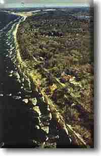
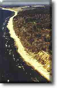
The Holmberg website states “The system has successfully restored more than 100 miles of beaches on Great Lakes and ocean shorelines. Studies demonstrate that the technology is a true breakthrough in coastal erosion control. System cost is significantly less than traditional methods because storm energy itself is harnessed to produce lasting benefits.” Below is an example from their website, showing a ‘before and after’ treatment scenario.
On right – 10 months after treatment
Below are further examples of the Holmberg treatment, left before, right after.
Numerous further examples of the success of the Holmberg methodology are to be found by visiting www.blufferosion.com/medium.asp whilst videos may be seen going to www.erosion.com/video.asp
Sand Rx
Another innovative methodology that does not involve major engineering is proposed by Blaise McArdles Sand-Rx website which describes the situation of erosion and the system methodology. It works by harnessing natural forces and uses natural substances that would normally be found in the sea and distributed in the sand of a healthy beach and foreshore. This involves treatment of the sand particles so as to improve their cohesion, so preventing their loss to the foreshore from eroding waves and draw-down.
The process is innovative in that it addresses the presence of an erosion causing pollutant called fumed silica (silicon dioxide) present in our seas. This is used in to promote free flow and anti-caking properties in powdered cement, mortar, stucco and plaster mixes. Scientists calculate that an average of 390 grams of fumed silica exists per cubic metre of salt water now in all of the major oceans and seas. Aggregates, as they are heaped up on the barges, are treated with an even coating of fumed silica which prevents any contamination of the harvested aggregates.
Sand Rx treats the sand with a polymer that returns fresh water holding capacity back to sand aggregates by removing one hydrogen molecule from these silica coatings that have devastated the worlds beaches and oceans. It further would stabilise beaches where the coarse sand and grit to fine sand and silt ratio has been degraded due to deposition of the wash-off from offshore dredging operations.
Applying the material is very easy and can be performed on a three mile beach stretch in a day by just one or two volunteers once the material is blended locally.

Picture two shows fumed silica coating on plastic debris taken from off shore from a treatment site.

Picture three shows fresh water spheres taken from inside plastic sand bags located on Nags Head. Note the fine sand aggregates inside the spheres and the insulating oil film on the outside of the spheres along the fumed silica shell (which may be likened to microscopic battery). This picture is reflected on drops of salt water taken from a discarded bag on Nags Head.
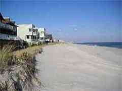
The Sand-Rx methodology appears to work well within a very short space of time. Not only does it build the beach by the promotion of particle cohesion, so addressing the loss of that sand that disappears offshore, but attenuates wave energy cycles and rapidly gives the return of the benthic community.
The two pictures below give an impressive ‘before and after’ treatment scenario.
Experts in the field report “This bio-mitigation concept appears to have considerable merit for sandy shorelines. It, as yet, does not have any substantiated evidence as to its long life; however, given its relatively low cost in material and application, it may be well worth exploring as a rapid response, stopgap method for sandy areas threatened by severe erosion, and perhaps the solution in the long term too.
Blaise Mc Cardle has several test projects along the US East Coast and is now beginning a demonstration in Cancun, the famous Mexican holiday resort which beach was devastated by the recent hurricane. He is seeking similar demonstration sites in the UK, so if you know of some possible sites that would benefit and where he might demonstrate the effectiveness of his idea, you may want to contact him by e-mail at email hidden; JavaScript is required.
Frond Mats aka ‘Artificial Seaweed’
Artificial Seaweed was used in 1981/2 to protect the Cape Hatteris Lighthouse in a one year trial. It proved to be highly effective in building up a considerable amount of sand in front of the light, also working to reduce current energy forcing deposition of suspended sand. Unfortunately the high energy forces at the Cape eventually caused it to shred and drift away from its positioning, consequently negating its gains.
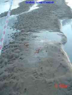
We have a company providing such protection in the UK, Seabed Scour Control Systems (SSCS) Limited of Great Yarmouth (Tel: 01493-443380, Fax: 01493-443390, E-Mail: email hidden; JavaScript is required. They have been involved in the prevention of scour since the early 1980s. Up to now SSCS has principally been serving the Oil and Gas industry, although more recently the company has graduated to Inland river and coastal projects both in the UK and overseas, in addition to some offshore wind farm developments.
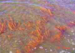
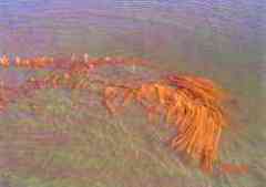
Brian Smith, Operations Director of SSCS, has kindly provided photographs of the effect of stabilising a shoreline by the use of artificial seaweed. The methodology appears to be highly effective, as shown by the following photographs taken twenty-four hours and fifteen days after emplacement in the Duddon Estuary in October 2004.
The above photographs show mats 24 hours after placement with sand build-up over mats.
The pair above show the resultant build-up just 15 days later.
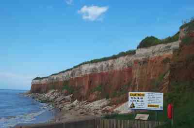
Massive engineering schemes are put to shame by one valiant resident of Old Hunstanton, where the strikingly layered cliffs are falling into the sea now that the lowered beach is allowing the waves to reach, attack and undermine the colourful cliffs. This brave man has spent five hours every day for five years, in all weathers, throwing back one by one the stones fallen from the cliff face, carefully segregating the red, brown and white to place at the cliff base. Dwarfed by the towering cliff, he can just be seen adding more to the piles he has already created. A spit in the ocean for sure, but cumulatively effective!
Rubber Tyre Recycling
Whilst being an excellent means of recycling the nations huge stock of used and discarded rubber tyres, the use of these in defending our shorelines was at first considered questionable. Although well dispersed and diluted by the sea, the solvents used with neoprene in tyre manufacture is not benign, nor is the cadmium present in the wire of tyres. Abrasion of the material by stones and sand under storm conditions has the potential to liberate shards of metal and rubber to the marine environment and thus routed into the gut of fish, sea mammals and birds. We are already well aware of the damaging effects of plastic materials in the marine environment, and that of particulate neoprene could be similar.
Initially HR Wallingford investigated the potential before allowing such use, with the result that the Environment Agency seemed quite happy to permit the use of discarded tyres as sea defences.
In their 11th August 2005 bulletin, the European Marine Sand And Gravel Group (EMSAGG) gave details of the use of rubber tyres at Poole Bay and at Pevensey, where in November 2002 350 tyre bales containing 40,000 old tyres were buried in the beach, with sampling wells created to allow monitoring for any adverse environmental effects. Further information on this is available from the report of the 15th EMSAAG meeting by reading the item entitled ‘All tyred out – using tyre bales at Pevensey Beach’ that is to be found at www.ciria.org/emsagg/pdf/emsaggissue11.pdf
Since then the issue has been further researched by a MARINET member very enthusiastic to see such recycling. He prefers to remain anonymous. His very thorough Internet search showed up a highly comprehensive and exhaustive study by CIRIA running to six chapters entitled ‘Multi-functional artificial reefs Scoping Study’ This is to be found by visiting www.ciria.org
Whilst such methodology does not overcome the likelihood of dredging induced beach draw down that could undermine the structures, it does appear to offer at least a short term method of defence at a low installation cost and the re-use of undesirable discards to land fill or the other alternative of incineration that would give such serious air-pollution.
Surfing Reefs
Information on recreational Surfing Reefs is to be found by going to www.surfline.com/surfnews/2005_02_24_artificial.cfm
The question arises as to whether they assist in erosion prevention. Having many in the USA and Australia, but relatively few in the UK, the value of Surfing Reefs in combating coastal erosion really needs to come from abroad. An informative major source for this is to be seen as an interview with a Surfrider official in SurfMag on Internet at www.surfermag.com/features/oneworld/reefnelson
Long established Surfing Reefs are known to exist at Miami and Vero Beach, USA, several in California and at Narrowneck, Cable and Pratte’s Reef in Australia. These appear to have been a mixed bag with the claimed success only being at their creation of surf breaks. They are promoted as also having a benefit of protecting the coastline from erosion, but there seems little to evidence this effect. To your author it is sad that large amounts of capital can be found for a recreational structure, but nothing is found to protect the coast from the erosion hotspots this might cause.
A Prefabricated Erosion Prevention (PEP) reef was installed off Vero Beach, Florida, in June 1996. It was placed in four segments of 3,000 feet to break wave forces to counteract erosion. The State Department of Environmental Regulation has given it mediocre scores, at best. A professional reviewer states that there’s not enough objective evidence that they work. One of two PEP Reefs installed at Palm Beach was scattered by a storm according to its assistance city manager.
Soft Cliff Protection
Soft sand and clay cliffs can rapidly be lost due to underminement as the beach sand is lowered, resulting in falls of material that temporarily provide beach refurbishment, but soon swept out to sea again lowering the beach base to repeat the process. Some alleviation is possible by drains to lower the cliff water content so as to limit slippage, but firmer protection is often justified.
At Overstrand in North Norfolk heavy flints have been used held in place by “gabions”, strong wire mesh cages, which if of stainless steel will last for a surprising amount of time. This most certainly has considerably prolonged the lifetime of the cliffs, and as flint is used for many older buildings and churches in Norfolk, is aesthetically acceptable.
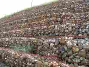
This photograph taken by Ian Denney shows Overstrand’s soft sand cliff frontage, high enough to combat even high wave crests on peak tides. Note though that it is oxidising, and thus the life expectancy limited. But note also how Marram Grass has managed to obtain a foothold.
A web search for “Sea Defences” and “Coastal Flooding” will reveal many hundreds of pages more on the topic and include further detail and photographs of many of the defences mentioned in this treatise.
Summary
It is now apparent that whilst most of the old groyne type sea defences were effective, many of these have been allowed to decay. They had their built-in unsustainability too as tropical hardwoods were used for their construction.
These forms were superseded by expensive heavy engineering projects that whilst protecting those areas where they were affordable, were also found to have a very finite lifetime when their fronting beach was lowered. They further denied natural sediment transfer to non-defended adjacent areas. The experiment of changing the structures from hard defences at right angles to the shoreline to parallel to the shoreline was also seen to suffer critical limitations not to mention the high costs.
But now we have available new concepts that appear to be functional without the severe drawbacks and high cost of their forerunners. These seem to offer the answer to the long ongoing problem of defending our coastline and vulnerable low elevation inland areas from an ever rising more angry sea and the threat given by offshore aggregate dredging.
It would appear that few, if any of these more modern but effective methods have been attempted along the now rapidly eroding coastline of eastern Britain. But if the objective of ‘managed retreat’, i.e. ceasing to prevent the loss of our beaches, dunes and soft sand cliffs is to save money, as well as to provide the release of further aggregates for export, for the construction industry and for income to the treasury, that would account for the present attitude of our government in promoting plans to cease to protect our vulnerable coastal environment.
The overwhelming rejection of the Shoreline Management Plan to aid and abet this loss for short term economic benefit may yet be achieved if sanity is to prevail.
Acknowledgements
Thanks are due to the many knowledgeable experts who provided valuable information, facts, statistics and observations as inputs for this treatise. They include Jenny Thompson of East Coast Images, Blaise McCardle, Jerry Byrne of Sustainable Coastlines, Coastal Engineer David Schultz, Brian Smith of Seabed Scour Control Systems (SSCS), Eurosion, many fishermen, beachcombers and coastal dwellers with a direct and historical knowledge of the coast and sea, and numerous others with a sound and meaningful practical knowledge based on experience and understanding.
Pat Gowen, 30th November 2005Updated 25th April 2008
