Coastal Loss at Winterton, Norfolk
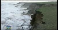
The following aerial photograph taken by Mike Page (his copyright) shows the southern end of the Great Winterton Valley AONB, from Winterton-on-Sea (top) to Hemsby Gap (bottom) as seen at high tide on 13th May 2004.

The Winterton Beach Café, still there thanks to North Norfolk Council’s earlier protective action in placing the undermined WW-II anti-tank blocks at the base of the eroding dunes (see the details at the top of ‘Why Canute Failed’, whilst Pat and Norma Gowen’s coastal bungalow is one quarter of the way up from the bottom of the article. The V2 rocket crater (for reference see ‘Recent Coastal Loss of Norfolk’) is the sandy hole half way up right on the yellow line.
The drawn-in yellow line follows the current dune front existing at mid-October 2012, much having been being lost to erosion in the past five months, the vast majority in October 2011. It is feared that if the current rate of erosion continues, as well it may, over the winter through to March 2013, this beautiful valley will be lost to the sea.
PG 25/10/’12


