
Project to survey UK coastal archaeological remains
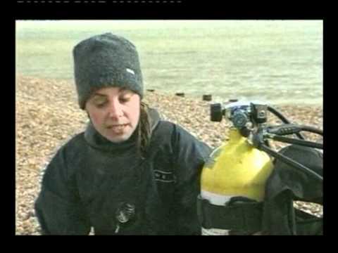
The Guardian reports, 3rd August 2015: A small army of volunteers, backed by drone technology, is being recruited to record and monitor the longest archaeological site in Britain: 5,600 miles of English coastline and tidal foreshore containing some 70,000 sites at risk of being destroyed by changing sea levels or coastal erosion.
The drones are being sent in as the safest and quickest way to survey large sites where there is little more than an hour of working time between tides.
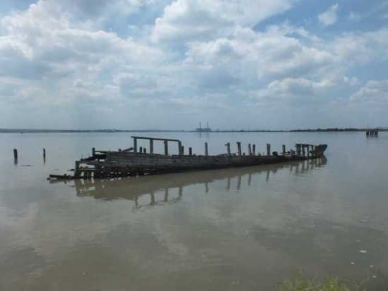
Excavation and recording work began this week at the Isle of Sheppey, Kent, where drone-mounted cameras have revealed a gaping hole in the flank of an early 20th-century vessel, the Hans Egede, a three-masted grain ship built in Denmark in 1922.
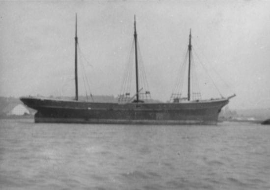
After surviving a fire at sea and spending years moored in the Medway and being used as storage, it sank while being towed in the 60s. It was finally beached off Cliffe, where it has been a spooky landmark. It suffered further serious damage in the winter storms of 2013.
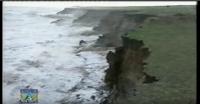
The drones, archaeologists and volunteers being trained in survey work are also working on Cliffe Fort, a derelict artillery fort built in the 1860s and subject from the start to erosion and flooding.
The thousands of other sites at risk include first and second world war guard posts known as pillboxes, medieval abbeys, Roman port buildings, prehistoric forests and more than 1,500 abandoned boats, barges and ships. A first world war coastal battery at Morecambe Bay and prehistoric burial mounds at Low Hauxley in Northumberland are among sites completely destroyed in recent years.
Gustav Milne, leader of the Coastal and Intertidal Zone Archaeological Network, the first coordinated national attempt to tackle the problem, has been watching the weather map anxiously, and particularly the storms about to hit the south-west coast.
“We have pillboxes which in living memory were standing safe and sound on the cliff top and are now lying broken into pieces on the tide line — and if the sea can do that to solid concrete, just imagine the threat to more fragile remains.
“Every storm we are losing material forever, every storm shows us again how urgent the task is, not just how much is being lost but how urgent the job is of at least recording what is about to be lost. Clearly, we can’t dig up the timbers of every drowned forest — but we can at least establish a baseline for monitoring what is happening.”
The drones, he said, were very useful for carrying out a rapid initial survey of a potentially difficult and dangerous large site: “We are employing some of the very latest technology to save some of the very oldest levels of archaeology.”
He hopes the volunteers will be able to pass on their new skills to others, so that the coast will be ringed by observers trained to spot problems and call in the experts if needed.
His front line troops are what he calls “the dog-walking faction” — “they’re the ones who really are out there every day in all weathers” — so one of the places where the project is setting up a recruiting stall is the Dorset dogs festival later this week.
The project is a joint campaign led by the Museum of London Archaeology, and funded by the Heritage Lottery Fund, Historic England, the Crown estate and the National Trust, which between them own thousands of miles of coastline.
Source: The Guardian, 3rd August 2015. For the full text, see www.theguardian.com/environment/2015/aug/03/drones-british-coast-volunteers