
Brain Morgan – How polluted is your river? How to find out and how to access the data – Oct 21
Defra has produced a new version of their Catchment Data Explorer. This gives you individual river pollution data from Sept 2021, and is a greatly amended version from the old system and supplies far more pollution data.
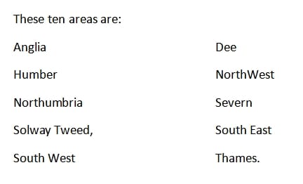
It is arranged to cover ten River Basin areas in England. See map:

Each river basin contains many lesser catchments, arranged in this manner:
Management Catchments of which there are very few.
Operational Catchments of which there are more.
Water bodies (i.e. rivers, streams, canals lakes and reservoirs) of which there are many.
To access the overall picture, Google:
“Catchment Data Explorer, England” https://environment.data.gov.uk/catchment-planning
This shows you your choice of river basin to examine.
For example, let us try the river Severn:
Enter ‘Severn’ into the Catchment Data Explorer search box, and click Search.
The next page will show, along the top line, that there are 7 Management Catchments (MC), click this and this will reveal these 7 management catchments.
Now, for practice, select Severn Vale from the names highlighted in blue.
This will reveal 8 lesser or Operational Catchments (OC).
Now, continuing the practice, select Forest of Dean. This will give you 6 water bodies in the Operational Catchment (OC).
Continuing, now select Blackpool Bk (Beck) which shows that it has Poor Ecological Status.
Then, by scrolling down this page, you can find out what the problem is. Here it is said to be ecological, with macrophytes (larger water plants) and phytobenthos (smaller to microscopic plants and animals) being the cause but, in this case, it is not able to give you a more specific reason. This reason is likely to be over-growth of these plants due to excess nutrients, like phosphorus and nitrogen compounds, from agricultural and/or sewage waste.
By scrolling further down the page you will learn about the Chemical Status of the water body and the reasons for any problems with its chemical status. There is a wealth of information.
I have added together all the water bodies in the Severn Management Catchment, and I make it that there are 488 in total. Each of these is treated separately in the data, with fairly close detail in individual maps.
This way you should be able to locate problems right down to those in small streams, anywhere in England.
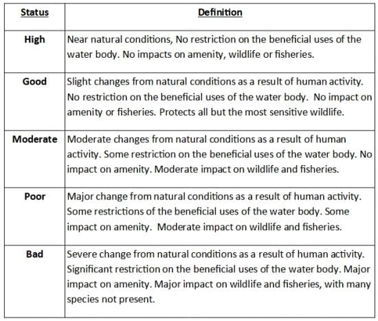
These are categorised in the following table.
Ecological and chemical impact on water bodies